Dry conditions are already in place, and strong winds arriving Friday could quickly turn a small spark into a fast-moving wildfire across parts of northeast California and northwest Nevada.
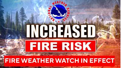
According to the National Weather Service in Reno in an online post Wednesday, a fire weather watch will be in effect from 1 p.m. to 9 p.m. Friday for eastern Lassen County, Surprise Valley and northern Washoe County.
An approaching cold front is expected to bring increased wind gusts Friday afternoon and evening. Those winds, combined with very warm and dry conditions since the start of October, are expected to bring elevated to critical fire weather conditions across the area.
West winds are expected to reach 15 to 20 mph, with gusts up to 35 mph. Minimum relative humidity is expected to range from 12% to 17%.
The National Weather Service lists the fire weather threat at risk level 3 out of 5. The most critical conditions are expected to last about two to five hours.
The combination of gusty winds and low humidity can cause fires to rapidly grow in size and intensity before first responders can contain them, according to the National Weather Service.
People are urged to avoid activities that could create sparks near dry vegetation. That includes yard work, target shooting, campfires, dragging trailer chains and driving over dry grass.
The National Weather Service also urged people to follow local fire restrictions and monitor weather updates as Friday approaches.
(The National Weather Service contributed to this story.)