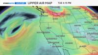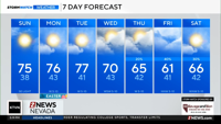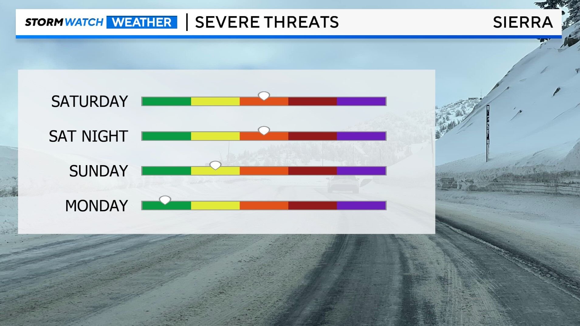
Snow is likely in the Sierra this weekend, and chain controls are possible, especially late Saturday into Sunday morning. A Winter Storm Warning is posted for the Sierra, from northeast California down through Mono County from 11am Saturday through 8am Sunday because of slick roads, and low visibility. This storm will produce a lot of wind, lowering visibility and leading to power outages. A High Wind Warning is posted for the Truckee Meadows and down through southern Lyon County from Saturday morning through Saturday evening, with wind gusts reaching 60mph in wind prone areas. Wind gusts could top 70mph in the high Sierra this weekend. Wind is driven by changes in temperature. The greater the difference, the stronger the wind typically is. This is called a pressure gradient, and it will be tight over the weekend.

An impressive cold front will slice through northern Nevada on Saturday, dropping temperatures into the 50’s come Sunday. The snow level will reach roughly 5500’ Sunday morning, and stay at pass level on Saturday itself. The best chance for accumulations and slick roads is after sunset on Saturday. While it will be snowing during the day on Saturday, warmer ground temperatures will make it tougher for the snow to stick. It will be warm enough for just rain in the valley. Hard freezes and frost is possible Sunday and Monday morning, especially in outlying areas above 4500’, so you’ll want to protect any sensitive vegetation. Visibility will be poor in the Sierra during the day, causing some delays along our mountain passes.

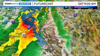
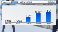
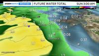
There will be some shadowing with this storm, keeping a lot of the rain and snow in the mountains, but there will be some rain showers in the valley too. As the front moves in from the west northwest, there should be enough force to lift the air over the Sierra, and give Reno some rain. Water totals including rain and liquid snow amounts could reach a couple inches in the Tahoe Basin, with snow totals at lake level ranging from three to seven inches. Places like Donner Pass, could see upwards of eight inches of snow by late Sunday morning. The crest could even see over a foot. Rain totals in Reno will be light to moderate, with less than a quarter of an inch falling.

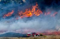
The low will come down from the Aleutian Islands, and bring cold air and moisture along with it. Snow is not unheard of in May, but this will be a decent storm for this time of year. Flights may be delayed on Saturday because of turbulence. High profile vehicles will have a hard time staying upright in wind prone areas like Washoe Valley and along 395 on Saturday too. Power outages and down tree branches also can’t be ruled out. Wind speeds will be lighter on Sunday, but it will be chilly. Quieter weather returns on Monday.