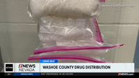
Ski Patrol Stresses Backcountry Safety Jan 24, 2023 Jan 24, 2023 Updated Jan 24, 2023 Facebook Twitter WhatsApp SMS Email Print Copy article link Save Ski patrol is just asking that folks be cautious if they decide to leave behind the groomed runs and hit the backcountry trails. Watch more Man arrested in Washoe County drug investigation Man arrested after fiery crash in Carson City Some Southern California residents remain under evacuation orders Facebook Twitter WhatsApp SMS Email Print Copy article link Save Currently in Reno 43° Partly Cloudy68° / 32° 3 AM 41° 4 AM 40° 5 AM 39° 6 AM 39° 7 AM 38° Watch 2 News Most Popular Articles Videos ArticlesMan suspected of shooting at Carson City traffic cameras, before leading deputies on chaseMan faces several charges after Washoe County drug investigation inInter-Tribal Council of Nevada overdraws alleged $1.6 millionReno firefighters extinguish car fire in north RenoTrump budget seeks $1.5T in defense spending alongside cuts in domestic programsWoman killed in head-on crash in Mineral County identifiedDayton man arrested on felony child abuse chargeNHP identifies Sparks woman who died in Sun Valley Blvd. crashNDOT to begin project to replace seven interstate bridgesTrail safety with the Nevada Department of Wildlife Videos {{title}} {{summary}} Notifications Settings You don't have any notifications. Get up-to-the-minute news sent straight to your device. Topics Breaking News Subscribe