
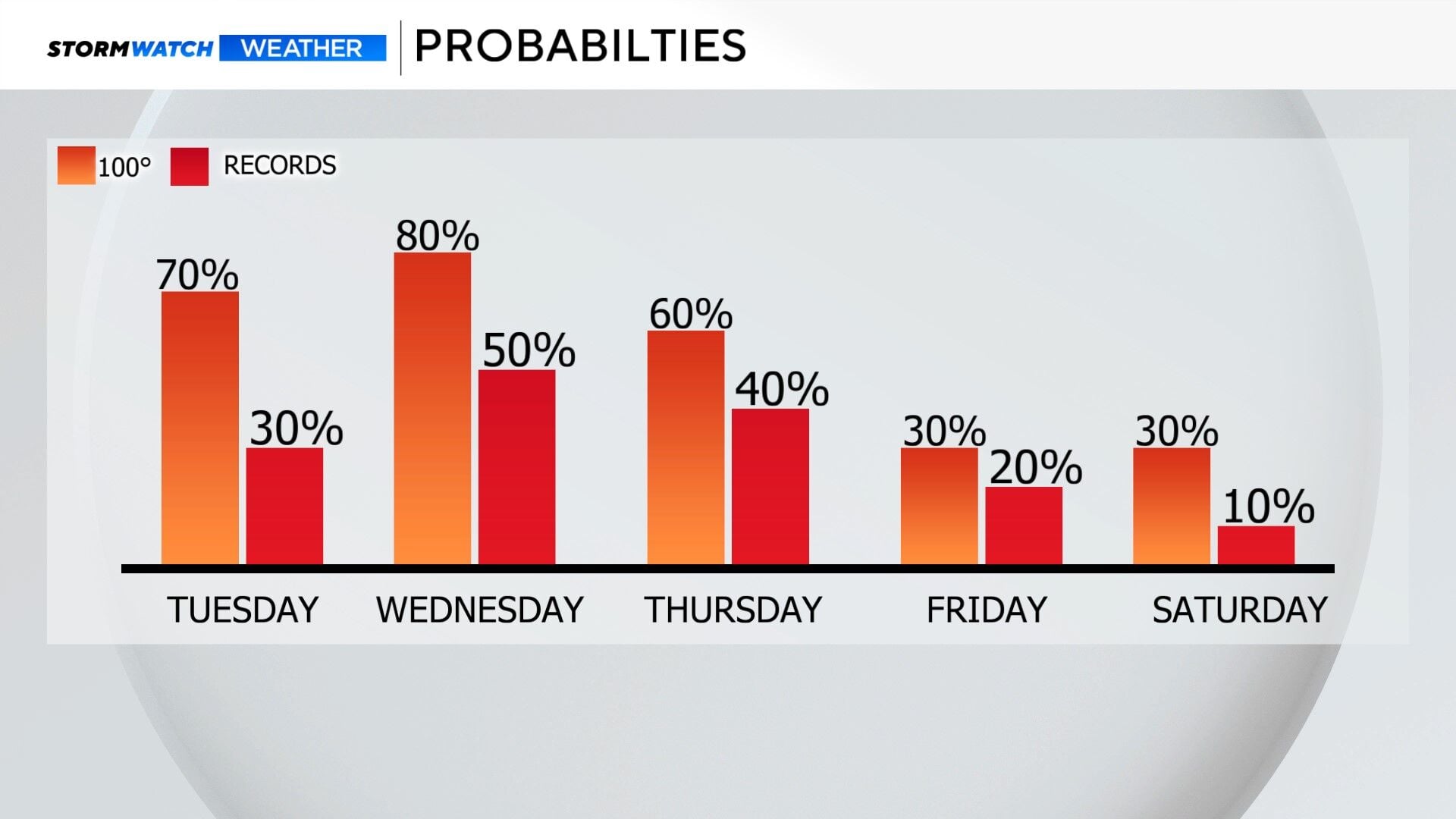
A heat wave is kicking in with triple digits possible on Tuesday and Wednesday. Reno will come very close to reaching 100 degrees both days, but it will be a close call. A heat wave is technically at least two days in a row with temperatures abnormally hot. This is not a specific guideline, but does give us a frame of reference. The criteria for a heat wave changes from place to place, depending on what is normal for your location. The average high for Reno this time of year is in the mid 80’s, but that doesn’t mean we don’t ever see 90 degree weather in June.


While it does not happen every year, triple digits are not unheard of in Reno during the month of June. On average, between 1991-2020, Reno typically sees its first triple digit day around July 10th. Last year we saw our first 100 degree day on July 12th , but the year before that was June 22nd. Reno saw four triple digit days in June of 2021, but zero in 2025.

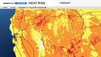
A Heat Advisory is up for the Western Basin and Range from 11 AM Tuesday through 5 AM Wednesday, where temperatures could reach the triple digits. It will be warm at night as well. In Reno, highs will be in the upper 90’s to possibly 100 degrees, but no advisories or warnings are issued at this time. Lows will be in the mid 60’s. Reno’s average low is 54 degrees during the middle of June. There is a moderate heat risk in the Truckee Meadows on Tuesday, and a moderate to major heat risk in Pershing and Churchill Counties. The ice cream forecast calls for three ice cream treats through Wednesday.


It will be hot at Lake Tahoe as well, with highs pushing 90 degrees. Records could be broken there as well. The record to beat in South Tahoe is 88 degrees on Tuesday, and the forecasted high is 87, so it will be close.