

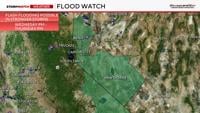
Fire danger goes down on Wednesday as rain chances go up for Northern Nevada. Some of the rain could be heavy and slow moving leading to flash flooding and debris flows. Burn scars are very vulnerable to debris flows, as well as ongoing fires. The rain will be great in that it will lower the fire risk, but too much at once can be problematic as well. The odds of it raining over the Bug and Stallion Fires is 20% on Tuesday, 40% Wednesday, and a 60% chance on Thursday. Notice it’s not 100% but it is certainly possible.
An Areal Flood Watch is up for Mono, Mineral, and Lyon Counties from Wednesday afternoon through Thursday evening, as well as a watch for the Reno, Carson City, and Minden areas from Wednesday through Thursday due to pockets of heavy rain and the potential for flash flooding and debris flows. Along with recent fires and burn scars, steep terrain and flood prone areas are of the highest concern. Now is the time to clear out any drains of debris.

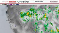
The moisture is taking its time expanding north, but there is enough moisture south of I-80 for storms Tuesday afternoon. Storm coverage expands northward Tuesday evening nearing I-80 at Fernley, but the storms will have less rain further north as well.
Fire starts can’t be ruled out due to dry lightning, north of Highway 50. Reno has a better chance for showers and storms on Wednesday, but the majority of them will develop just east of Reno along and east of US-95. The focal point will be where the west wind meets a southerly wind, and on Wednesday that will be just east of Reno.

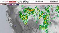
By Thursday, instability increases quite a bit and moisture levels expands north and west. This gives Reno a 60% chance for showers and storms. Most of the showers will be moderate in nature, but some of them could be heavy and slow moving leading to flash flooding. The setup on Wednesday is hybrid, with a mix of both dry and wet storms. By Thursday the storms will have plentiful moisture to work with area wide.


Both flash flooding and additional fire starts are possible through Friday in Northern Nevada. Burn scars, steep terrain, and poor drainage areas are the must susceptible to flash flooding and debris flows this week. The flooding won’t be widespread, but is possible in pockets.
An area of low pressure is moving south pumping in moisture from the south in advance of it. Sometimes a low can switch our winds to out the west, making it dry, but other times a low can increase our storm chances by increasing instability and pulling in moisture from the south. This setup is the latter. CAPE values, or food for the storms will be higher on Thursday as well as moisture levels.

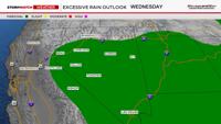
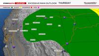
There is a marginal chance of rainfall totals exceeding flash flood guidance on Wednesday and Thursday, which is a 5% chance within 25 miles. The same goes for Thursday.
Rain totals will vary quite a bit, ranging from .10-.75 inches. Most locations will get around a quarter of an inch. Rain totals will be higher south of I-80 and east of Reno.

Thunderstorms are scattered, so not everyone will get wet. Gusty outflow winds are also possible with any storms that do develop, especially north of I-80 where there is not as much moisture on Tuesday and Wednesday.