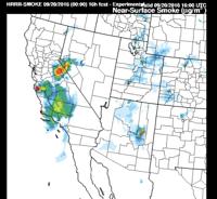
More smoke and haze will move into the region on Tuesday which in return may worsen the air quality, especially south of Reno. Majority of the haze will come in from California, both from the Soberanes fire and the Owens fire located east of June Lake. The HRRR model is through NOAA. The red color indicates higher amounts of smoke in the region.

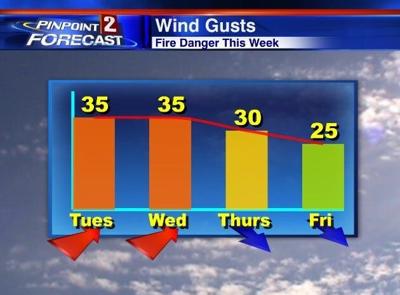
Fire danger will be critical on Tuesday as our winds top twenty miles per hour and the relative humidity stays low. Red Flag Warning goes from noon to 8pm Tuesday and then we have a Fire Weather Watch for Wednesday.


Winds are expected to be the highest north of Interstate 80. Thanks to the wind, it won’t be the best boating weather either.

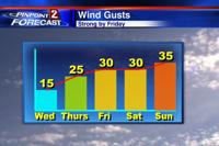

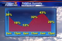
Our winds will be strong as we transition between high pressure and low pressure. The low is located in the Gulf of Alaska and will move towards Nevada midweek. The change in pressure creates gusty winds, especially when there is a big temperature difference. Majority of the moisture will stay to our east. I’ve been watching the tropics, and it looks like the remnants of Paine will stay well east of the Truckee Meadows on Tuesday. Granted more moisture will move into central and eastern Nevada come Wednesday. Some of the rain on Thursday could be heavy at times.
Remember it only takes a single spark for a fire start, so make sure to stay fire aware.