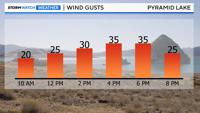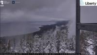


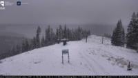
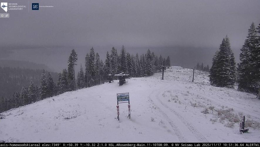
A cold storm continues today, bringing cool temperatures, rain, mountain snow, and breezy winds.
Precipitation is expected to continue through Tuesday, with impacts likely to be minor to moderate in the Sierra and Eastern Sierra. Snow levels will start around 6,500 feet in the morning, dropping to around 5,500 feet by afternoon.
Snow and rain will spread into Nevada by the afternoon, with potential slick roads, especially overnight. I think we will see rain to the valley floor with mixed precip along foothills, and snow above 6000 feet. Confidence is still uncertain if we will see any snow less than 6000 feet.
Precipitation will shift south of I-80 by Tuesday afternoon, with snow levels rising through the day. Highs will be a few degrees warmer than today, with lows dipping into the 20s and 30s to wake up to on Wednesday.
After a brief break on Wednesday, another Pacific storm is expected to bring rain and snow back to the region by Thursday.
Portions of I-80 over Donner Summit and Mt. Rose Highway were temporarily closed due to snowy conditions. (Both rest areas along I-80 at the summit are closed for snow removal)
You can use Nevada 511 and Caltrans QuickMap to keep an eye on road conditions this winter.
STORM CAUSES ROAD CLOSURES & CHAIN CONTROL
— CHP South Lake Tahoe (@CHPSouthLake) November 17, 2025
CLOSED:
Monitor Pass (SR-89)
Ebbetts Pass (SR-4)
CHAIN CONTROL:
SR-4 Cottage Springs (Calaveras Co.) to Mt. Reba (Alpine Co.)
I-80 Kingvale (Placer Co.) to Donner Lake Interchange (Nevada Co.)
Luther Pass (SR-89) pic.twitter.com/EdLgnz29ZB
Temperatures today will be in the upper 40s throughout the Truckee Meadows and the Carson Valley while lower 40s take over Sierra communities.
Snow values have dropped between 3-6 inches above 6500 feet, as wintry mix will be expected above 5800 feet.
Happy Monday! Here is a preliminary look at rain totals from this morning with scattered showers and isolated thunderstorms expected later this afternoon and evening. #CAwx https://t.co/2XW0TB05lT
— NWS Sacramento (@NWSSacramento) November 17, 2025
As precipitation begins to move out of the Valley and into the mountains & foothills, here's a look at the latest forecast rain & mountain snow totals. #Cawx pic.twitter.com/BjQP8Pm70r
— NWS Sacramento (@NWSSacramento) November 17, 2025