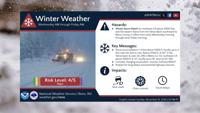
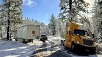
A winter weather system is expected to bring snow, gusty winds and hazardous travel conditions to the Sierra and parts of northeastern California this week, with some impacts beginning Sunday night.

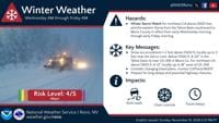
National Weather Service Reno reports the strongest storm is expected to arrive midweek, bringing periods of heavy snowfall, strong wind gusts and possible whiteout conditions.
Drivers heading into the Sierra should prepare for changing road conditions, chain controls and potential travel delays. Those with plans to go over Donner Pass are encouraged to complete their trips by Tuesday night.
A weaker system is expected to bring snow to higher elevations beginning Sunday night. The first round of snow could create slick roads and difficult driving conditions during Monday's morning and evening commutes.

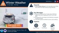
The National Weather Service has issued a Winter Weather Advisory for the Tahoe Basin above 7,000 feet from 10 p.m. Sunday through 7 p.m. Monday.
Find the latest storm information at the National Weather Service-Reno and the latest chain control updates at NVRoads.