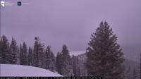
Areas of snow and snow showers will continue today through this evening, with potential for light snow accumulations over western Nevada valley floors.
Drier weather is anticipated it return Friday, with a warming trend through the weekend.
Active weather returns next week, with increased chances for a stronger storm next Wednesday and Thursday.
Bands of light snow showers continue to push eastward across Plumas/Sierra counties and western Nevada mainly from US-50 northward.
Expect slick driving conditions especially for road segments near or above 5000 feet including I-580 south of Reno and US-395 through the North Valleys.
Farther south along the Sierra into Mono County, a few snow shower bands will also push through while in the Basin and Range, US-50 well east of Fallon from Sand Springs Summit to New Pass.