
From dust storms to thunderstorms and smoke, July brought us our fair share of active weather. At least the last nine days of it anyways. Despite having a surplus for the month of July, Reno still has some catch up work to do for the water year which ends September 30th. We still have a deficit of 1.01" at the airport.
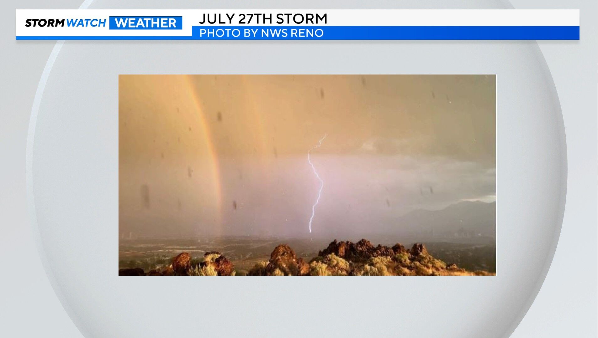
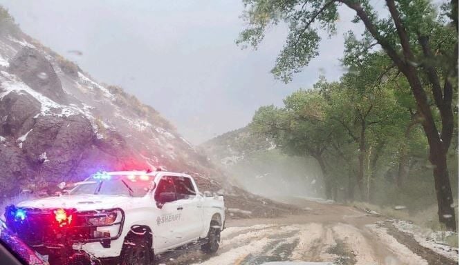
Around eight tenths fell at the Reno Airport during the month of July, around six tenths of inch on Jul 27th alone. This was a high intensity storm, especially for our area. The National Weather Service in Reno says it was the second largest summer rainstorm the office has seen since the early 90's. Two inches of rain was also reported at Rancho San Rafael, all within an hours time. Mudflows and hail was also seen in Storey County. The storm started in Storey County then expanded northwest over Reno. The photo below is from the Storey County Sheriff's Office showing hail and mudflows over Six Mile Canyon.

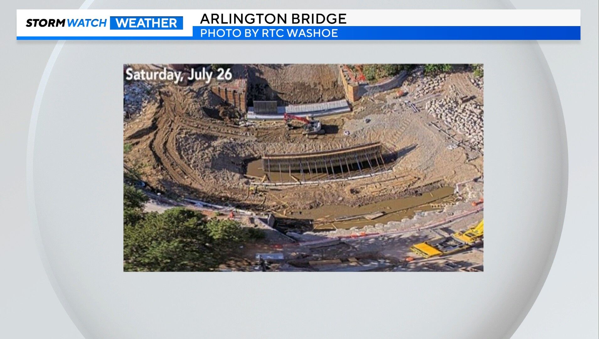
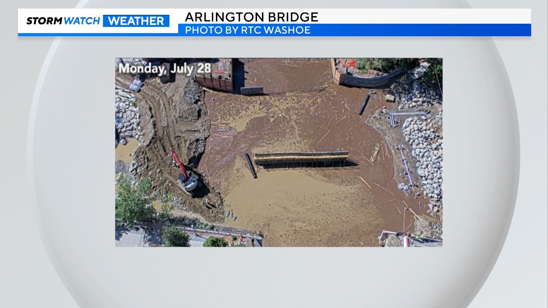
The change after the storm at the Arlington Bridge construction site is impressive, with a lot of mud getting stirred up because of the storm.


The drought monitor labels much of western Nevada as abnormally dry, and puts southern Nevada in a severe to extreme drought. Northern California is doing better for the water year than central and eastern Nevada. Northeast California and northwest Nevada saw a significant increase in soil moisture after the storms.

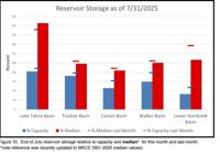
Luckily our basins are doing well, with the Tahoe Basin reporting above normal levels and the Truckee staying near normal. The Truckee River's streamflow is near normal as well. The Carson and Walker is reporting below normal stream flows. The Truckee in Reno, rose two feet within just over an hours time on July 27th. The river stayed below minor flood stage, but rose a good amount within a short time.