Rain can be a good thing, but too much of it can lead to flooding. A Flood Watch is posted for the Truckee Meadows, including southern Washoe County, Carson, Douglas, Lyon, Mono, and Mineral Counties through Wednesday evening because of strong thunderstorms. The storms will last longer than the past few days and will be stronger too. This will make for a stormy drive home from work, but they could start around 1pm in South Lake Tahoe and Mono County. They’ll start a couple hours later in the Reno area, right around the evening commute.


Not everyone will get wet Wednesday afternoon, but the storms will be numerous. Most of them will be along and east of Highway 95 and up and down the Pine Nut Range. There is a 60% chance of storms in Reno, and a 80% chance in places like Hawthorne, Yerington, and Lovelock. Sparks and Fernley has a better chance of seeing rain than northwest Reno.


Moisture builds with each day storms develop, so after a few days of stormy weather, the Truckee Meadows is primed for rain. While rain lowers the fire risk, the trick is to always get the rain lined up perfectly with the lightning. The fire risk is lower than if there was no rain forecasted, but it’s not zero either.


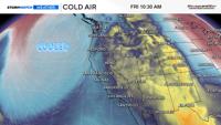
A trough will edge its way into our region the next few days, eventually cooling us down and drying us out. The trough will be far enough away and close enough at the same time to strengthen any storms that do develop. Lows can help the air to rise, making storms stronger. High pressure has been in place lately, not giving the storms a ton of extra lift. Storms like to form along the jet stream, and as the ridge moves east and the trough moves in, they’ll try to form in between the two. Dry southwesterly flow will take over by Friday, shutting down the storm threat. Dry southwesterly flow usually lowers the amount of CAPE in the atmosphere, which is a measure of how much potential energy we have to work with, or how easily air will be able to rise. CAPE values will be pretty high for our area by this afternoon.


Precipitable water is a measure of water in the air, and we have a good amount to work with for our area. Drier air will nose into western Nevada Thursday afternoon, and overtake our area by Friday. Models are showing PW values over .8" later today, which is high for western Nevada. There will be less moisture to work with near the Oregon and Idaho border. Drier air will increase the threat for strong winds in northeast California and far northwest Nevada by Wednesday afternoon. Gusty outflow winds are possible area wide on Wednesday, but the threat is higher to the north, where there is less moisture.