
Whether it is snowing, raining, windy, or sunny the jet stream always plays a role in the weather.
It flows in a west to east pattern and each hemisphere has a couple of them. There is a polar jet located around 50/60 degrees north and south and then there is also the subtropical jet located around 30 degrees north. The jet stream expands farther north during the summer, because warm air rises.
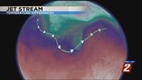
The jet stream can be thought of as a fast moving river of air that drives our weather. Like the jet stream, the fastest part of the river is in the center, and then it slows down as it moves towards the outer banks. It can also carry things down stream or become very stagnant.

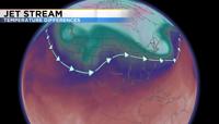
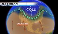
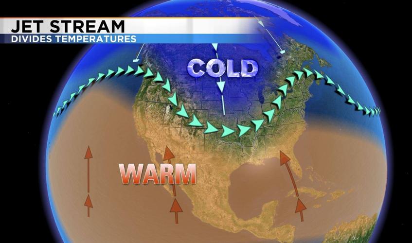
It forms from temperature differences between the equator and the poles. Warm air rises and cold air sinks. This creates a circulation or current of air with the jet stream separating warm air to the south and cold air to the north. The stronger the temperature difference the stronger the wind.
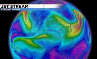
Located about five to ten miles above the surface, the jet stream usually reaches wind speeds of 100 miles per hour, but can exceed 250 miles per hour. Planes usually fly within the jet stream, and since it flows from west to east, a flight from California to New York would be faster than the other way around.

The jet stream also looks a lot like a jump rope with ridges and troughs or hills and valleys. The bigger the dip in the jet stream typically the colder it will be. Huge troughs are usually harder to get rid of then smaller ones.

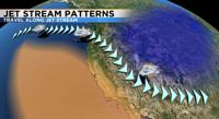
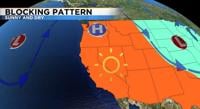
Sometimes storms can hop along the jet stream like a slide and move southeast, which is what’s been happening a lot lately. Other times the jet stream can create a blocking pattern that keeps storms in one spot causing flooding rains or it can keep storms from causing a dry spell or heat wave. Because fronts usually break a part as they hit the west coast, the jet stream is a bigger player for us.