

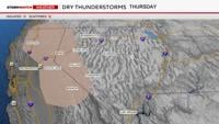
Fire danger is critical on Thursday and Friday in Northern Nevada. Red Flag Warnings are up for the Truckee Meadows on Thursday, and much of Northern Nevada on Friday, including Reno. Thunderstorms are already starting to develop in the Northern Sierra early Thursday afternoon, and will expand south and east as the day goes on. Due to lightning, thunderstorms typically pose a fire risk in Northern Nevada, but when rain is lacking the threat is even higher.

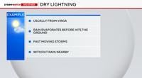
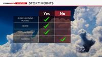
Dry lightning is possible on Thursday and Friday, but overall the storms will be mixed with rain and dry air. According to NOAA, dry lightning occurs when there is lightning without the presence of rain. Some local offices or fire experts also include super light amounts of rain in the definition of dry lightning.
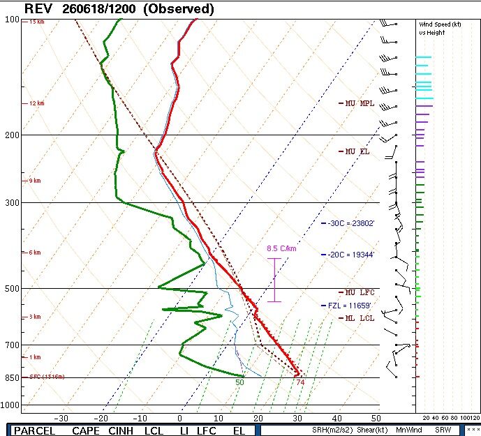
The red line represents temperature while the green line represents dewpoint. The further away the lines are, the drier the air is.
True dry lightning does not happen very often, but when it does it is usually from virga. This is when the rain evaporates before it hits the ground. This can happen in Northern Nevada and is possible both on Thursday and Friday. The latest sounding, or profile of the atmosphere shows a dry layer of air at the surface, which means virga and gusty outflow winds are possible.

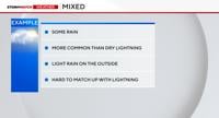
Mixed thunderstorms are more common and pose a fire risk as well. The storms on Thursday and Friday will mainly be mixed, but some of them could be dry. While dry lightning is without rain, mixed storms produce rain, but the rain cores are typically small, and the rain is light on the outside. This makes it challenging for the lightning to strike within the rain itself. Lightning can strike up to 10 miles outside of a storm.

Fast moving storms pose a bigger fire danger than slow moving storms that sit there. Slow storms gather moisture with time, and stationary storms can even lead to flash flooding. Fast moving storms don’t have the time required to saturate and produce a lot of rain. The jet stream plays a big role in the speed of the storms. When a low is close by, it can propel the storms along. The trough moving into California will help speed up the storms on Thursday and Friday and move them northeast.

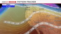
As the trough moves east on Friday, storm coverage expands eastward as well. The storms will also be able to follow the jet stream, moving at a decent pace. By day two of storms, more moisture will be available to work with, but dry lightning is still possible.

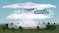
Gusty outflow winds are also possible with any storm that does develop, increasing fire danger. Outflow winds are a surge of wind coming out of the downdraft of a storm in a variety of directions. This makes fire spread hard to predict and contain.