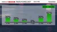
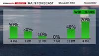
More moisture is what you need to combat fires, and thankfully more is moving in here as I type this. While there is a 30% chance of it raining over the Bug Fire on Wednesday, there is a 50% chance over the Stallion Fire. By Thursday, the showers and storms will be more widespread and heavy rain producers. There is a 60% chance of seeing rain over the Bug Fire on Thursday and a 70% chance over the Stallion Fire.


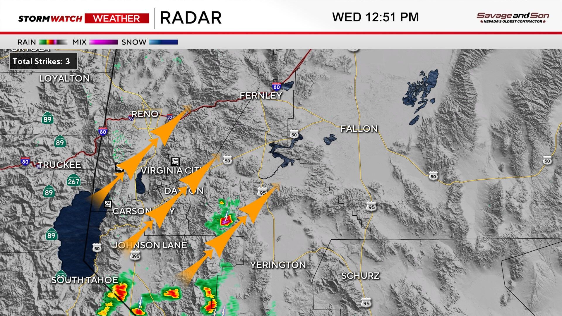
Majority of the showers and storms will be along and east of US-95 on Wednesday, but a stray shower or two will clip the eastern side of Reno and Sparks on Wednesday as well. The storms will begin to loose moisture north of I-80, so dry lightning can’t be ruled out in Northern Washoe County either. Gusty outflow winds between 40-50 mph is possible with any storms that do develop, increasing fire danger. Gusty winds are problematic because they are strong and erratic, making the fire hard to contain and predict.


Best chance for wetting rains is south of I-80 and east of Reno, while the best chance for dry lightning is in Northern Washoe County and around Lake Tahoe.
The storms are moving fairly slowly in Douglas, Lyon, and Mineral Counties, with some decent sized rain cores, but also some lightning. The trick is to get the lightning matched up perfectly with the rain itself. Showers and storms has its pros and cons. Overall, more moisture with higher relative humidity values is a good thing for fire fighters. The storms are moving to the north northeast, which means east Reno has a better chance of getting wet on Wednesday than northwest Reno.

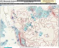
CAPE is shown in red, with values around 1000 j/kg. This is pretty high for our area.
The ingredients are there for thunderstorms on Wednesday and Thursday. CAPE values are around 1000 j/kg in western Nevada, which is enough for thunder and lightning. Precipitable Water values are above average for our area too. So we have the instability and moisture to get storms going. Storms are as far north as Carson City Wednesday afternoon at 1:15pm, and will reach I-80 by 3:30 pm. Storms will redevelop on Thursday by 1 pm. Once again starting south and expanding north as the day goes on.

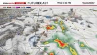
Most of the storms will stay east of Reno Wednesday afternoon, but one or two will clip Sparks and east Reno. There is a better chance for rain on Thursday.
A Flood Watch is up for much of Western Nevada, including over the Bug and Stallion Fires on Wednesday and Thursday. The flooding won’t be widespread, but patchy. Now is the time to clear any drains from debris. Be prepared for ponding along roadways for the drive home. Especially along I-80 from USA Parkway.
Heavy rain over burn scars and fires can lead to debris flows, if you get too much at once. This can’t be ruled out, but overall, the added moisture is a good thing, lowering fire danger.