
A storm will move through the region late Wednesday into Thursday, and the National Weather Service has issued a Winter Weather Advisory for the Sierra as well as Northern Nevada as a result.
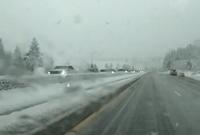
Elevations between 5000’ and 6000’ could see a couple inches of snowfall, but the lowest elevations will see an inch or less. The Sierra could see between 6-12 inches of snow by Thursday afternoon, mainly above 7000’. It will be warm enough in Reno to fall as just rain Wednesday evening, before switching to snow early Thursday morning when people are driving to work.
Meteorologists can see a storm coming days in advance, and depending on the storms severity the National Weather Service will issue an advisory or a warning. A watch is issued days before the storm itself moves through. A watch means the ingredients are there for a storm to materialize, but it hasn’t come together yet. At this point, it’s just something to watch. Some people like the snow more than others.
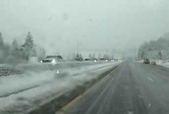
"I don't mind it just because I'm used to it, but it makes me uncomfortable with how fast people are driving now,” said local resident Sydney Darby.
"I am looking forward to it cause I think we need it, but I'm going to stay home. I'm not looking forward to driving in it right now,” said local resident Brandi Jorgenson.
As the projected storm gets closer the weather service may replace it with a Winter Weather Advisory or a Winter Storm Warning. If this happens, it means the weather service is confident the storm is happening, and are no longer just watching for a possibility of a storm. This is similar to going from having all the pieces of a puzzle in a box to finishing it.
Both an advisory and a warning means roads will be impacted and drivers should be aware. A warning is more significant, and the criteria for both a warning and advisory can vary from region to region. The NWS in Reno will typically issue an advisory when the valley sees 2 inches or more within 12 hours or 3 inches of snow within 24 hours. A Winter Storm Warning is twice that. For elevations between 5000 and 7000’ the criteria for a Winter Weather Advisory is bit higher. Around four inches would have to fall over 12 hours or six inches throughout 24 hours for an advisory to be issued. A Winter Storm Warning would be twice these amounts. Keep in mind the alert criteria is flexible, and advisories or warnings could still be issued for lower amounts if impacts are high enough. A blizzard is more about wind speeds and low visibility than it is about heavy snow. To be considered a blizzard, the storm must lower the visibility to at least a quarter of a mile with sustained winds of 35mph or higher, and last for at least three hours.
It does not take a lot of snow to make roadways slick. Frozen puddles and fog can be a problem after the storm has passed too.