With the start of 2020 comes another year of weather in Northern Nevada. Long term forecasting is a challenge, but the models are showing a couple weak systems moving through over the next week or so, before the gates open up again for stronger storms to roll through around mid January.
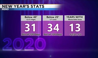
New Year’s Eve was chilly, but nothing out of the ordinary. It’s been colder. Over the past 120 years we’ve had highs below 40 degrees on New Year’s Eve only around 30 times, and lows below 20 degrees on New Year’s Day around 30 times as well.
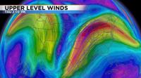
We’ve seen snow at the Reno Airport only 13 times for New Year’s. The jet stream is what drives our weather and looks like a wooden roller coaster with valleys and hills. Or it can be called ridges and troughs. A ridge typically brings quiet weather and a low brings stormy weather, especially in the wintertime. The jet stream also keeps warm air to the south and cold air to the north. Sometimes little waves can hop along the jet stream and bring rain along the outer edge of it. Even with a ridge. For example, a wave can be moving through Seattle and then hitch a ridge on the jet stream and travel southeast. For now, we have a pretty strong ridge in place, but it will move east Thursday night.

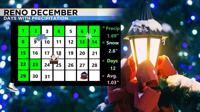
December was a fairly typical month for us with several storms moving through and some cold weather. We even had a slightly above month in terms of precipitation.

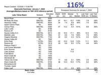
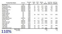
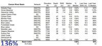
After a slow start to this year's snow season, the stormy pattern really got going around Thanksgiving. Since then it has not been as active but our snowpack is near normal. Hopefully we can get some more storms to move in this January. The following charts are from the NRCS and USDA.