
AUGUST 12, 11:55 P.M. UPDATE:
With a flood watch in effect until 9 p.m. on Thursday, sandbag locations have been set up region-wide.
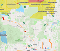
Perimeter Map is showing people where those locations are.
Just look for the green circles. You can find the locations nearest to you at this link.
An example of what to look for can be seen below.

ORIGINAL ARTICLE (AUGUST 12, 3:22 P.M.):
The National Weather Service in Reno has issued a flash flood warning for south-central Washoe County and Storey County until 6:15 p.m., with flash flood warning sor Spanish Springs and Highway 445 expiring at 7 p.m.
Doppler radar indicated thunderstorms with heavy rain across the areas warned at around 3:15 p.m., with flash flooding ongoing or expected to start soon.
The flooding is expected to impact Reno, Sparks, Hidden Valley, Damonte Ranch, Lockwood, the Reno-Tahoe International Airport, Spanish Springs, Highway 445, and Mustang.
Small creeks and streams, urban areas, highways, streets, underpasses, low-lying areas, and anyplace with poor drainage are expected to be impacted.
You are advised not to attempt to drive through flooded roads. Most flood deaths happen in vehicles.
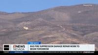
Meanwhile, some flash flood warnings are coming in contact with areas where wildfires are burning, with rain expected to fall where they are burning.
"It’s a fine line between the right amount of rain… and too much rain in short period of time," said 2 News Nevada Chief Meteorologist Chris Larson. "But rain falling directly on the fire is a blessing for firefighters working to gain control over the Bug and Stallion Fires. In some places on the eastern flank of the Bug fire… radar estimates are that more than an inch may have already fallen."