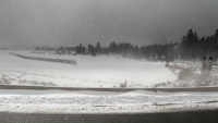


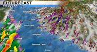


Heavy snow and strong winds are on the way by Friday morning with several inches of snow around our valleys and 1 to 3 feet of snow in the mountains through Saturday morning.
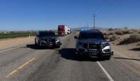
I-80 traffic is currently being held from the Nevada state line through Colfax due to whiteout conditions. Check https://quickmap.dot.ca.gov/ for the latest.
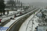
Plan on snowy roads for the Friday morning commute and chain controls along our mountain passes and even road closures.
Gusty winds will create whiteout conditions and hazardous driving conditions.
Temperatures will remain very cold with 20s and 30s and wind chill values in the teens and single digits.
Avalanche danger is high in the backcountry as well.
A break in the weather by Saturday afternoon through Sunday, with another round of snow on the way by early next week.
Check www.nvroads.com for the road conditions.
Here are the observed snowfall amounts from the region in the past 24 hours: https://t.co/vMpIXipbLO
— NWS Reno (@NWSReno) February 23, 2023
To see estimated snowfall amounts from the National Operational Hydrologic Remote Sensing Center, please visit: https://t.co/3zw71KyBPN
The Sierra Avalanche Center has issued a Backcountry Avalanche Watch for the Central Sierra Nevada from Yuba Pass to Ebbetts Pass, including the Greater Lake Tahoe Area. This watch is in effect from 7:00 AM Friday until 7:00 AM PST Sunday. pic.twitter.com/d6v2YnhyNj
— NWS Reno (@NWSReno) February 23, 2023