The National Weather Service issued a high wind warning for the valley that expires at 10 p.m. on Monday. Widespread power outages are expected and travel will be difficult, especially for high profile vehicles.
The National Weather Service says now is the time to secure loose outdoor items such as patio furniture and trash cans before winds increase and blow these items away.
You can prepare ahead of time by making sure you have extra food and water on hand, as well as flashlights with spare batteries and/or candles in the event of a power outage.

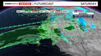
Travel will be a mess through much of next week in the Sierra, and at times in the valley as well. Not only because of mountain snow but also because of strong winds and heavy rain. An atmospheric river is starting to get organized and move onshore Friday morning, with snow likely at Donner through at least early Friday night.
A Winter Weather Advisory is posted for the western slope of the Sierra, the Tahoe Basin, and northeast California this weekend - each of them going through different times.
The Advisory for the Tahoe Basin goes through late Saturday, before switching to a Winter Storm Watch overnight. The Advisory for the western slope of the Sierra goes through Sunday at 4am. This will be a long lasting storm with multiple rounds of rain, snow, and wind. The precipitation will be more steady on some days than others. There will be more wind than rain in the valley on Sunday and Monday as the atmospheric river wiggles to the north.

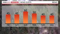
The atmospheric river will lift slightly north on Sunday, decreasing rain chances in the valley and making wind speeds stronger. A High Wind Watch is posted for the Truckee Meadows, including southern Washoe County, Lyon, Mineral, and Mono Counties from Sunday morning through Sunday night with wind gusts near 60mph in many locations. Ridge tops could see wind gusts around 100mph this weekend. I would not be surprised if wind gusts exceeded 65mph in places like Washoe Valley on Sunday.

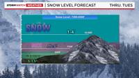
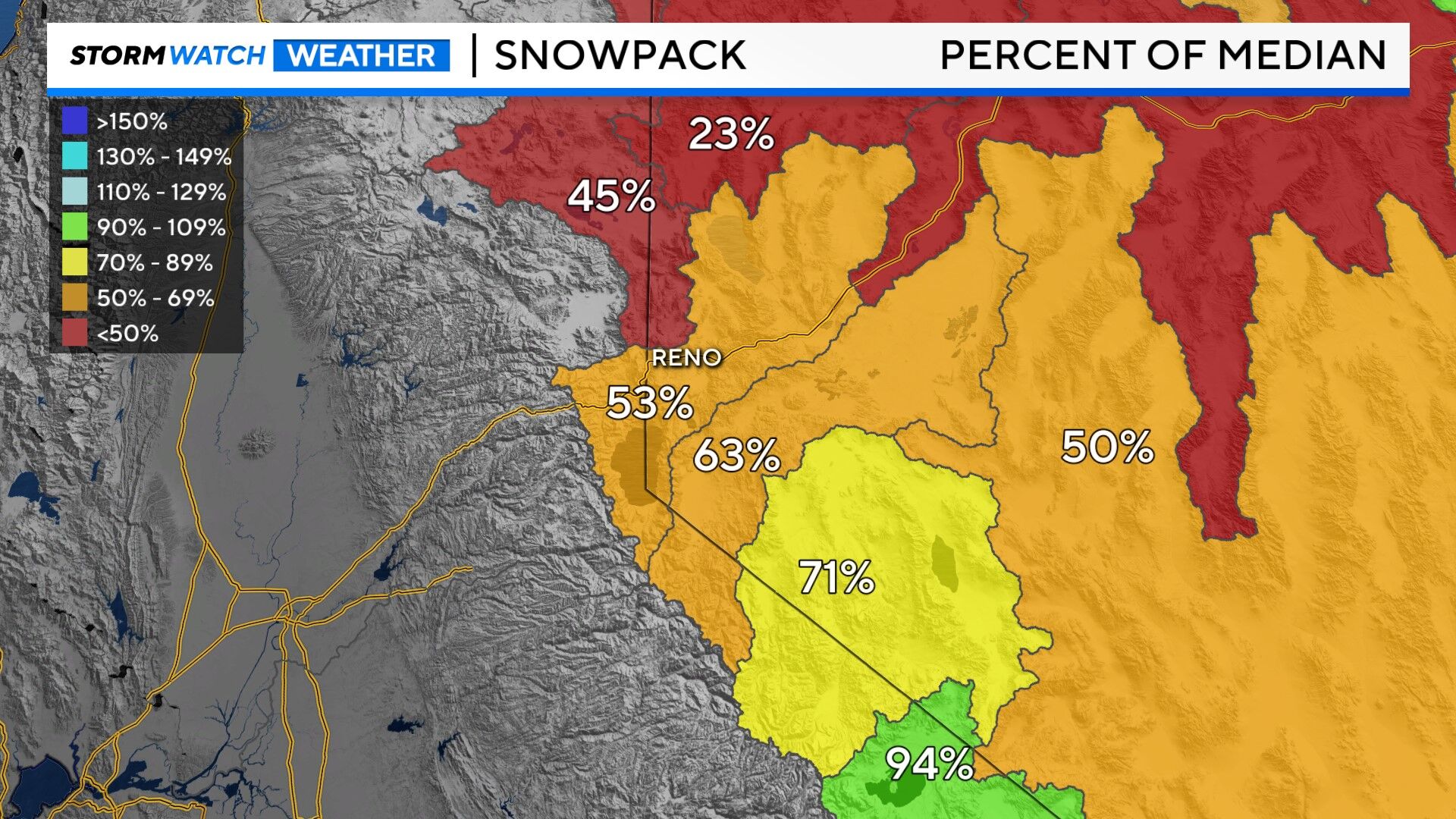
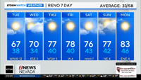
Rain totals will exceed a quarter of an inch in the valley, with an inch likely by Saturday night. Two inches is not totally out the question either. Lake Tahoe will see more rain than snow this weekend, with around a couple inches of rain falling in the bucket. Granted, some snow is possible at lake level Friday as well. The snow level will hover around 8000’ on Saturday, with heavy rain falling along I-80 at Donner. Even though it won’t be snowing there all weekend, even rain can cause some problems.

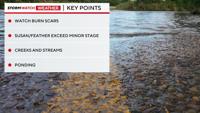
Now is the time to clean any blocked gutters and storm drains, as this could lead to standing water. Creeks and streams will rise quite a bit, but the Truckee River in Reno is forecasted to stay well below action stage. The Susan River is now forecasted to exceed minor flood stage, as well as the Feather River. The West Fork of the Carson River is forecasted to reach action stage around Sunday morning as well. How high our rivers and streams rise is highly dependent on how much wind vs rain we see.
We'll be watching our burn scars for debris flows as well. Stay tuned for updates.
If you concerned or live in an area that's prone to flooding, it's important to load up on sandbags as soon as possible in order to prevent possible water damage on your property. You can find sandbag locations by clicking in the story below.