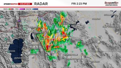


A Severe Thunderstorm Warning is up for a storm located near Dayton and includes the counties of: Storey, South Central Washoe, Eastern Carson City, and Central Lyon. The warning goes through 2:45pm. According to radar, the storm is capable of producing quarter sized hail and 60mph wind gusts. This is strong enough to damage your car and damage roofs, fences, and sidings.
The storm is moving at 10mph to the north, towards Virginia City. Lots of lightning is also being detected, most of it striking within the rain core itself (according to radar). The web cam near Stage Coach does show some rain falling, but it’s hard to get confirmation in the field with each storm, depending on web cam availability.
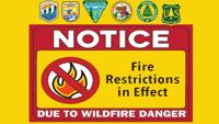
While some rain is falling from time to time in Reno, the storms are much stronger as of 2:15 just to the east of 395 near Dayton, Silver Springs, and Highway 95. While the fire risk is definitely there, the storms are not very fast, lowering the chance for dry lightning. Gusting outflow winds are still possible as well.
Reno still has a good chance at seeing strong storms through early tonight as well. The storms will lift to the northeast as the evening progresses. There is plenty of heat and energy for the storms to work with. Soundings earlier today still showed some dry air at the surface, so the fire risk remains.