

If you're hoping for snow, you'll have to get a snow globe to tide you over for a while. The air is just too dry to get any of the white stuff just yet.
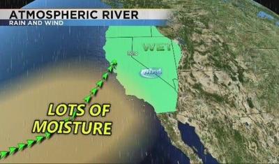
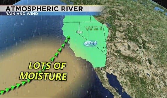
December and January are our two wettest months getting about an inch of liquid precipitation on average at the Reno Airport. Even higher than that if we have a lot of atmospheric river events. Atmospheric rivers bring warm moist air up from the Hawaiian Islands during the winter and early spring and can give us a significant amount of precipitation.
What made the 2016-2017 winter season so epic was the shear number of atmospheric river events we had. So much, it was the wettest water year on record at the Reno Airport.
While it was still cold, we've had colder winter seasons in Reno. Warm air holds more moisture than cold air. We've also been known to get some cold snow storms from the north. These events may have the same relative humidity as an atmospheric river event but different moisture contents. An atmospheric river is typically better for our water supply.
The relative humidity simply tells you the capacity of how much moisture the air can hold, where as the dew point is a better measure of how much moisture is in the air and how muggy it is outside.
Imagine you have two different jars of varying sizes but the same amount of water in them. This is equivalent to a system that has the same water content but different relative humidities. The shorter jar is full with a lower temperature and the other jar is fifty percent full and represents a warmer temperature. While the shorter jar is full enough to snow the taller one would have to cool off or get more moisture to snow. Granted thunderstorms can start with low relative humidities and then saturate as it grows.
A 100 percent relative humidity does not guarantee it will snow, but does up the chances. Let's hope that this coming winter will be a good one with plenty of moisture.
