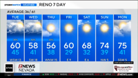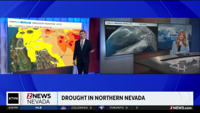
Our winter system is wrapping up and exiting today.
Lingering light snow showers will persist for northeastern California through the evening.
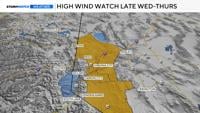
A colder midweek system brings the potential for valley snow late Wednesday into Thursday morning, bringing commute concerns. Warmer, drier weather returns for the end of the week.
There are some signals for a colder system mid-month, but confidence is low.
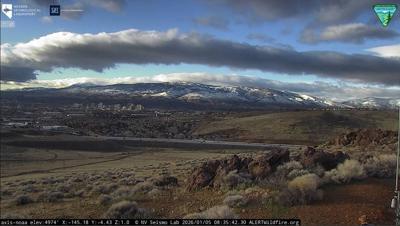
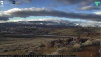
The troughing pattern that has taken residence this weekend is finally packing up and getting ready to leave.
As a parting gift, the system will continue to supply light snow showers to northeastern California through this evening.
The majority of these snow showers will be found along the crest of the northern Sierra,
focusing on Lassen and Plumas counties. There is still a 30-45% chance to see snow in and around the Tahoe Basin, with the better chances along the western ridges. Snow amounts should be light, on the order of 1-4 inches above 7000 ft in the Tahoe Basin and elsewhere in Lassen and Plumas along US-395.
Locally higher amounts up to a foot are still possible along the highest peaks of the Lassen County crest.