
According to the National Weather Service in Reno, drivers should keep an eye on changing conditions tonight into tomorrow morning as winter weather settles back in across parts of northern Nevada.
In an online post, the National Weather Service, Reno said, “Following the recent wintry precipitation, freezing fog may develop tonight into tomorrow morning, especially in the Sierra valleys. Please use caution if traveling through these areas, as roads may be slick and visibility may be reduced.”

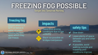
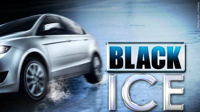
Freezing fog forms when temperatures drop to 32 degrees or below, and water droplets freeze on contact with surfaces. When that happens, visibility can quickly fall, and black ice can develop, especially on bridges and overpasses.
The National Weather Service says a Winter Weather Advisory remains in effect for the Greater Lake Tahoe Area until 10 a.m. PST.

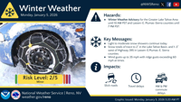
In Lassen, eastern Plumas, and eastern Sierra counties, the advisory continues until 7 p.m. PST.
Light to moderate snow showers are expected to continue through the day. Snow totals are forecast to range from a trace to two inches in the Lake Tahoe Basin, with one to three inches possible west of Highway 395 in Lassen, eastern Plumas, and eastern Sierra counties.
Wind gusts could reach up to 35 mph, with ridge gusts at times exceeding 60 mph. The overall risk level is listed as two out of five, considered minor.
Impacts include slick roads, travel delays, and slower morning and evening commutes.
Walking conditions tonight and tomorrow morning will also be icy. If you must walk outside, expect icy surfaces and use caution.
Weather officials recommend slowing down, leaving plenty of space between cars, and avoiding unnecessary travel until conditions improve.