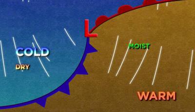
When there is a big change in the weather, cold fronts are oftentimes to blame. The summer is usually dominated by high pressure, but not so much during our other seasons. Cold fronts are more apparent in the rest of the country then the west coast. They usually fall apart as they move onshore. They have an even harder time making it past the Sierra. Over the past four years, I’ve seen warm fronts in our region less than a handful of times.

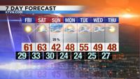
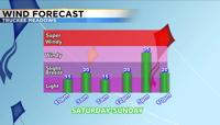
A strong cold front is expected to move through Northern Nevada late Saturday into Sunday morning. The front won’t be as strong as last weekend, but temperatures will drop about twenty degrees and it will be windy. Highs on Saturday will near 60 degrees and they’ll be in the low 40’s on Sunday. Usually the bigger the difference in temperature, the bigger the difference in pressure will be. A strong pressure difference leads to strong winds. Winds will be in the teens for much of Saturday, but they’ll be gusting in the low 20’s Saturday night. Sunday will be cool and windy with gusts in the mid 30’s. Sometimes wind speeds can be strong behind the front too.

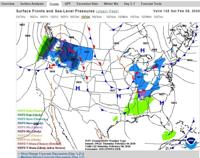
Cold fronts usually produce more wind than warm fronts. Warm fronts are known for bringing light drizzly weather with more moisture coming up behind it. A mid latitude cyclone is composed of both a cold front and a warm front. A cyclone moves in a counter clockwise fashion and is usually easier to define east of the west coast. All you have to do is pick out the wind direction and temperature changes to find the fronts. This makes forecasting a lot easier too. For example, there is a strong cold front moving through the southeast right now. On a low level chart you can clearly pick out the front, which is where the rain is. Winds are coming out of the south in front of the front and from the west northwest behind the front. You can also see the change in temperature. Fronts are much harder to pick out along the west coast. There are usually a variety of different wind directions within the Truckee Meadows itself. Our terrain causes wind directions and speeds to change all the time and from place to place.

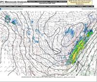
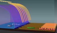
A cold front is defined as the leading edge of colder air. A warm front would be the leading edge of a warmer air mass. Cold air is more dense than warm air and can easily slide underneath the warmer air mass. This is one way for snow to form. A cold front is also a good lifting mechanism. Some people think of a cold front as a bulldozer. In Tornado Alley cold fronts are oftentimes triggers for strong storms. Thinking of a cold front as a bulldozer you can see how the front can get air to rise.

While a strong cold front will move through our area this weekend, not much precipitation is expected. Temperatures will be around 60 degrees through Saturday before dropping into the 40’s Sunday. Have a great day!