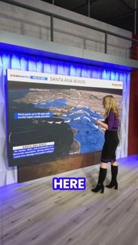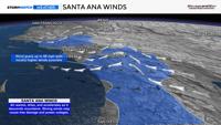
An east wind is uncommon in Northern Nevada, but it’s not unheard of. When it does happen, it reverses our normal wind pattern, with the potential for down sloping winds west of Reno into California.
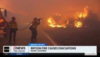
In Southern California, this is referred to as Santa Ana Winds. These winds increase fire danger, as wind speeds can be very strong and compress the air, drying it out.
There is a Red Flag Warning up for much of the Sierra through Friday, ending from north to south on that day.
For the Sierra just west of Tahoe, the Red Flag Warning wraps up Friday morning, but in southern California, they end Friday night. Wind gusts could reach 45 mph within warned areas.

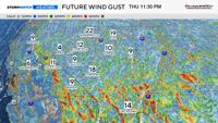
Latest observations as of Thursday afternoon show wind gusts around 40 mph at Slide Mountain and up to 79 mph at Kirkwood.
They’ve also been gusting in the 70s atop Ward Mountain at Alpine Meadows, in Palisades.
Wind speeds will reach their peak Thursday night, before easing on Friday. However, wind speeds will still be strong in southern California throughout much of the day.

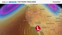
What’s causing these strong east winds is called a Rex Block. This occurs when there is a ridge to the north and a low to the south.
The combination of the two creates a wind pattern in the shape of a backwards “S.” This allows for an east wind to develop between the ridge and the low.
While it is a little bit breezy in the Truckee Meadows, wind speeds are much stronger to our west.
A west wind returns over the weekend with normal wind gusts in the 20s and 30s, before a trough arrives early next week.
This upcoming trough will increase wind speeds, drop temperatures, and give us a chance for valley rain and mountain snow. Stay tuned for more weather updates.