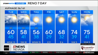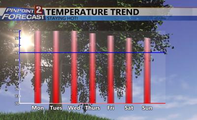
This will be the hottest week yet of 2018 in Northern Nevada with temperatures expected to reach the triple digits a few times. As high pressure builds over the west, temperatures will warm and storm chances will go up as well. Highs this week will range from around 100 degrees Monday to the upper 90’s by next weekend.


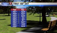
Looking back at the past several years we usually have our first 100 degree day towards the end of June, but this year we're a week or so behind. Not that anyone is complaining though right? Temperature dial is set on hot this week, if not extra hot. With warm afternoons it will also be warm in the morning with lows in the mid 60’s and a few clouds. High pressure will keep us hot, and with plenty of heat storms are possible by Thursday. While it will be hot this week, I don’t think it will be quite be hot enough to break any records at the Reno Airport, we would have to make it up to about 105 degrees to do that.

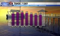
While we’ve had many days in the mid and upper 90’s so far this summer, this will be our first real shot at hitting 100 at the Reno Airport. Average temperature for this time of year is about 91 degrees. At Tahoe temperatures will be in the mid 80’s with only a few clouds.

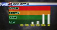
Storm chances go up as the week goes on. As the ridge strengthens out west the air will become more ready for storms to develop, with dry lightning a possibility, especially in the beginning. Strength of the storms does not appear to be all that impressive, but they could produce some lightning and gusty winds. Have a great week and stay cool.