


Update (5/9/2025, 2:18 p.m.):
In a post on X, the U.S. Department of Agriculture’s Forest Service, through the Carson Ranger District of the Humboldt-Toiyabe National Forest has announced that active burning is done for the Dog Valley prescribed burn.
Fire crews burned 576 acres over the last few days and will stay on scene monitoring the area of the burns through the weekend.
Officials say that smoke will still be visible for the next few days, and there is no need to call 911 to report the fire.
Original Story (5/7/2025, 8:33 a.m.):
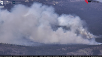
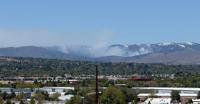
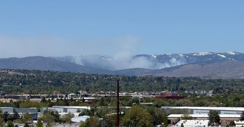
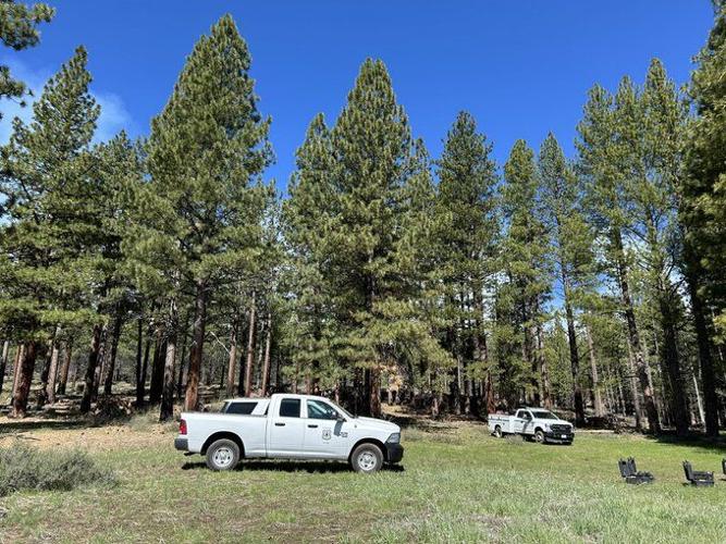
The U.S. Department of Agriculture’s Forest Service, through the Carson Ranger District of the Humboldt-Toiyabe National Forest, is continuing prescribed fire operations this week in Dog Valley, west of Reno.
The planned operation, which began Tuesday, May 6, is producing heavy smoke that has drifted across the region, pushing air quality into the unhealthy range.
As a result, health officials are urging caution, especially for people with heart or lung disease, older adults, children, and teens.
According to guidance from AirNow.gov, sensitive groups should:
- Avoid strenuous outdoor activities.
- Keep outdoor activities short.
- Consider moving physical activities indoors or rescheduling them.
For the general public, it's also wise to take precautions:
- Choose less strenuous outdoor activities (e.g., walking instead of running).
- Reduce the time spent outside.
- Plan outdoor activities for times when air quality improves.
Due to the volume of smoke, some residents have mistakenly reported the fire as uncontained.
However, this is a planned and controlled operation.
The Forest Service emphasizes that unless there is an actual emergency, calls to 911 are not necessary.
Local fire departments are already aware and coordinating as part of the operation.
The prescribed burn covers approximately 657 acres near Forest Service Road 002, northwest of Summit One and Henness Pass Road.
Public access to the area remains restricted during operations.
While the smoke may be disruptive, prescribed fire is a critical tool used to reduce hazardous fuels, improve soil health, and support forest resilience.
All burns are conducted under strict safety protocols based on wind, humidity, fuel moisture, and temperature.
Residents can monitor live smoke conditions via our Cloud Cam on the weather page of our website.
For further information, contact Fuels Specialist Jed Rudelbach at Jedidia.Rudelbach@usda.gov.
Forest Service crews are using drones to help ignite today’s prescribed burn in Dog Valley. Smoke will be visible in the area for the next few days, please do not call 911. pic.twitter.com/crZldLcHD2
— Humboldt Toiyabe NF (@HumboldtToiyabe) May 6, 2025
⚠️We are aware of smoke coming from the Dog Valley area (Verdi). This is a controlled burn. Avoid calling 911 at this time. @REMSAHealth @washoecounty @WashoeSheriff https://t.co/KODBJg1dZ9
— Truckee Meadows Fire & Rescue (@TMFPD) May 6, 2025