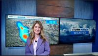

Seasonable temperatures continue with increasing clouds and a slight chance of showers and a few thunderstorms—mainly south of Highway 50. Areas like Mono and Alpine counties could see some afternoon storms and even light snow above 10,000 feet. Things dry out later in the day with a quiet Thursday ahead.
Looking ahead to the weekend, a modest atmospheric river system moves in early Saturday, bringing gusty winds, widespread rain, and high-elevation Sierra snow. Saturday will be the most active day, with southwest winds gusting 35 to 45 mph—and over 100 mph on Sierra ridgetops. That could mean hazardous travel for high-profile vehicles. Most of us will see rain, with up to an inch possible from the Tahoe Basin through Lassen County. Snow levels will be high—around 8,000 to 8,500 feet—but expect some slushy accumulations on the higher Sierra passes.
Temperatures take a tumble, cooling 15 to 20 degrees by Sunday. That means highs in the 70s on Friday will drop to the 50s in western Nevada by the end of the weekend, and even cooler in the Sierra.