South Korea Financial Markets
- Lee Jin-man - AP
- Updated
A dealer stands near the screens showing the foreign exchange rates at a dealing room of Hana Bank in Seoul, South Korea, Tuesday, Aug. 11, 2026.
Lee Jin-man - APAs featured on
U.S. stocks slipped a bit further from their records, while oil prices kept swinging on uncertainty about when the war with Iran will allow crude to flow freely again. The S&P 500 fell 0.3% Tuesday for a second modest drop since setting its all-time high at the end of last week. The Dow Jones Industrial Average dipped 0.3%, and the Nasdaq composite sank 0.6%. The price for a barrel of Brent crude rose 1.4% to $88.91 after earlier swinging between $87 and $90. Treasury yields eased in the bond market.
U.S. stocks are ticking toward an all-time high following the latest sign that inflation is getting less bad. Stocks are also getting a lift Thursday from easing oil prices in their latest yo-yo move. The S&P 500 rose 0.5% and was on track to top its record set last week. The Dow Jones Industrial Average rose 22 points, and the Nasdaq composite climbed 0.7%. Treasury yields eased in the bond market after a report showed that inflation at the U.S. wholesale level was not as bad in July as it was in June or as economists expected. Brent crude oil’s price fell 1.4%.
Weather Alert
...AIRPORT WEATHER WARNING... The National Weather Service in Reno has issued an Airport Weather Warning for... Reno-Tahoe International Airport /RNO/. The following weather hazards are expected: Cloud to ground lightning within 10 nm of the airport. LAT...LON 3960 11989 3960 11967 3942 11967 3942 11989
...THUNDERSTORMS DEVELOPING OVER WESTERN NEVADA...EASTERN SIERRA AND NORTHEAST CALIFORNIA THROUGH 100 PM PDT... At 1111 AM PDT, Doppler radar was tracking several showers and thunderstorms develop over hte region, moving northeast at 10 mph. HAZARD...Wind gusts up to 50 mph and pea size hail. SOURCE...Radar indicated. IMPACT...Gusty winds could knock down tree limbs and blow around unsecured objects. Minor hail damage to vegetation is possible. Locations impacted include... Reno, Carson City, South Lake Tahoe, Fallon, Mammoth Lakes, Lovelock, Gardnerville, Virginia City, June Lake, Pyramid Lake, Lee Vining, Lahontan Reservoir. PRECAUTIONARY/PREPAREDNESS ACTIONS... If outdoors, consider seeking shelter inside a building or vehicle. Torrential rainfall is likely as the thunderstorm gain strength this afternoon. Do not drive your vehicle through flooded roadways. A Flash Flood Watch remains in effect until 9 PM this evening. && MAX HAIL SIZE...0.25 IN; MAX WIND GUST...40 MPH
...FLOOD WATCH REMAINS IN EFFECT THROUGH THIS EVENING... * WHAT...Flash flooding caused by excessive rainfall continues to be possible. * WHERE...A portion of western Nevada, including the Greater Reno-Carson City-Minden Area. This includes the Bug and Stallion Fires. * WHEN...Through this evening. * IMPACTS...Excessive runoff may result in rock, mud, and debris flows in and near active fire perimeters, steep terrain, and poorly drained urban areas. * ADDITIONAL DETAILS... - Heavy rain from thunderstorms primarily during the afteroon and evening hours today. - http://www.weather.gov/safety/flood
Currently in Reno
Most Popular
Articles
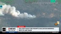
- Talbot Fire near Lake Tahoe prompts evacuation warnings
- Bug and Stallion fire crews push to secure fire lines before hotter, drier weather returns
- Reno launches rebate program to keep bears away from garbage
- Washoe County School District closes nine schools on Thursday amid area wildfires
- Eastbound Glendale closed at Bergin Way in Sparks due to flooding
- Rain is likely over the Bug and Stallion Fires this week
- With flood watch in place until 9 p.m. on Thursday, Perimeter Map shows sandbag locations
- Teen facing attempted murder charges after stabbing in South Lake Tahoe
- Eagle Fire in Douglas County burns 151 acres, 20% contained, prompts evacuation orders
- Planes at Reno-Stead Airport grounded due to weather
Get up-to-the-minute news sent straight to your device.