Featured Top Story
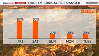
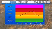
Fire danger will be elevated to critical on Friday as the Washoe Zephyr kicks in Friday afternoon and evening.
Fire danger will be elevated to critical on Friday as the Washoe Zephyr kicks in Friday afternoon and evening.
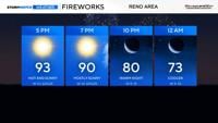
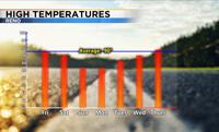
Highs will range from the mid 90’s in the Truckee Meadows to the mid 80’s around Lake Tahoe.
An isolated thunderstorm is possible as the front moves through on Friday, but chances are very low.
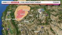
Fire danger increases this week as an area of low pressure slips in from the north. A Fire Weather Watch goes up for much of Northern Nevada F…
It will be cooler on the 4th of July with highs in the mid 80’s and mostly sunny skies.
Northern Nevada is a windy area, and the storm that moved through Thursday through Saturday produced wind gusts well over 40mph for much of th…
A Red Flag Warning is still in effect for the Truckee Meadows through 11pm Friday night because of gusty winds and low relative humidity value…
Fire danger is going to be elevated on Sunday and Monday, but at least winds will be lighter at night. Wind gusts will be near five miles per …
High pressure will keep temperatures above average through Saturday, before a trough moves inland by Monday. As the low gets closer, wind spee…
We have yet to make it up to 99 degrees this year in Reno with some hot days still thrown in this summer and some cooler than normal weekends too.
Get up-to-the-minute news sent straight to your device.