The National Weather Service in Reno has issued a severe thunderstorm warning for western Storey County and south central Washoe County until 6:45 p.m. tonight.
At 6:03 pm, National Weather Service Doppler Radar indicated a severe thunderstorm capable of producing quarter size hail and damaging winds in excess of 60 mph. This storm was located four miles east of Lockwood or 13 miles east of Reno and moving north at 20 mph.
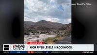
Locations affected include Lockwood, Tahoe-Reno Industrial Center and Virginia Peak.
This storm will affect Interstate 80 in Nevada between mile markers 20 and 33.
Precautionary/preparedness actions:
Doppler Radar has indicated weak rotation within this storm. Funnel clouds have been reported in the area. While not immediately likely, a tornado may still develop. If a tornado is spotted, act quickly and move to a place of safety in a sturdy structure such as a basement or small interior room.
You can stay up to date on weather in our area with our KTVN Storm Watch weather app.
The app gives you forecast information, like radar, storm tracking and more for any location in the country, all in the palm of your hand.
You can download it for free for your iPhone, iPad, or Android smartphone. Just search KTVN in the iTunes or Google Play Store.