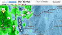
Nearly a third of an inch of rain fell at the Reno Airport on Monday, with higher amounts in west Reno. More rain will fall Tuesday evening.
Almost a third of an inch of rain fell at the Reno Airport on Monday, and more rain will fall Tuesday afternoon.
The atmosphere is primed for showers and storms. It feels muggy outside with dewpoints in the upper 50s and low 60s, which is very rare for our area. It feels more like Mississippi than Nevada. The moisture that is moving in is subtropical.
Rain totals will vary quite a bit, with some spots getting over an inch, while others receive less than a tenth.
That is the nature of scattered showers and thunderstorms. Power outages and fire starts can’t be ruled out, but flash flooding will be the main concern. Especially over burn scars.
Follow us on YouTube for more videos like this one.
If it does rain where you live, it will likely be moderate to heavy.
Storms that develop along and east of Reno will be stronger, with more rain than the ones that develop in the Truckee Meadows, thanks to a more southerly flow.
Tuesday is one of those days where it feels like it will rain.
Monsoonal moisture is wrapping around an area of high pressure located over the Four Corners and the Northern Plains.
The flow around a ridge is clockwise, giving way to a south wind in Nevada. A south wind brings moisture, while a west or southwest wind brings dry air.
This is why the position of the ridge is critical for an accurate forecast.

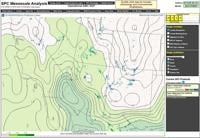
Precipitable water values vary throughout the country. For Northern Nevada, an inch of PW is a large amount of water content. This image was taken in real time around 1:45 pm.
Precipitable water values are well above average, with many locations south of I-80 seeing values over an inch. This is high for our area.
Precipitable water tells meteorologists how much water we have to work with.
Dewpoints are the temperature at which saturation occurs. The higher the dewpoint, the more muggy it feels outside. Temperatures are in the 80’s, but the muggy feel makes it feel much hotter.
Day two of thunderstorms are typically wetter than the first day. Leftover boundaries can also spark new thunderstorms the following day.
Surface CAPE (Convective Available Potential Energy) values are around 2,000 j/kg, which is very high for Northern Nevada.
This means storms and downpours are likely. Gusty, erratic winds are also possible. A sounding from Tuesday morning shows a moist layer of air near the surface. Rain is likely as a result.

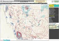
CAPE shows how likely the air is too rise. It is food for storms. Values over 1,000 j/kg is impressive for the Truckee Meadows and Tahoe Basin. This image was taken in real time around 1:45 pm on Tuesday.
The showers and storms will be moving fairly quickly along the jet stream, lowering the flood risk a little bit, but due to the abundance of moisture, the rain will be heavy at times, and flash flooding can’t be ruled out, especially over burn scars and areas that get hit with shower after shower.
This is called training. Most of the storms in the Reno area will be done by 8:30 p.m., However, storms in Fernley, Winnemucca, and Lovelock could last through 10 p.m.
Ponding is likely, and now is the time to clean any drains of debris.
Typical spots that flood could very well be covered in water by the drive home. It’s best to turn around if you run into standing water and do not drive through it. Standing water is oftentimes deeper than it appears.