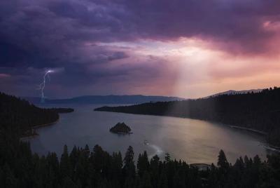
You can typically tell how strong a storm is by looking at the damage, and the storms that develop in our area are typically much weaker than say the plains or Midwest.
"Out in the plains it's kind of a different animal of how the storms form down there,” said meteorologist Tony Fuentes.
Our thunderstorms are usually much weaker and short lived. While we may have the ingredients to get storms going, we lack some of the ingredients to keep them going and get super strong.
"Really the number one thing is to get these organized thunderstorms to be super cells you need wind shear in the atmosphere which is a change in wind direction with height,” said Fuentes.
This change in wind direction with height not only allows the storms to rotate but it also separates the warm air from the cold air. When the air masses collide the cooler air kills the storm. This happens often in the Reno area.
"We can get 1" or 1.5" inch hail in some storms, tornadoes are rare but they do spin up weak end type tornadoes like Ef0 or Ef1,” said Fuentes.
Our thunderstorms usually forms underneath a ridge of high pressure, while out east they can get storms with a ridge too, this usually keeps them on the weaker side. However, when a low moves through and the atmosphere is still ripe with a lot of warm moist air it becomes a very dangerous situation. A low this time of year in the plains brings together a collision of air masses, all coming in at different wind directions. With a ridge you don’t typically get that. When a low does move through our area from the west sometimes we can get more wind than rain and thunderstorms out of it.