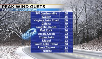
Wind speeds were strong enough Tuesday to cause some damage. Just southwest of Gardnerville saw wind gusts of 88 miles per hour and the Caughlin Ranch area saw a wind gust of 77 miles per hour. What makes these types of storms you would see in the late fall so dangerous is that they last a lot longer than say a heat driven summer thunderstorm which lasts for about a half hour. The longer the duration of a storm, the more opportunity there is for fire starts and damage.
To put this into perspective these are the type of winds you could see in a tropical storm. A tropical storm has sustained winds of at least 39 miles per hour. A category one hurricane would have sustained winds of at least 74 miles per hour and a category four hurricane like Iota would have sustained winds of at least 130. While we did see gusts top 70 miles per hour Tuesday, the sustained wind speeds were much lower.

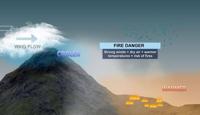
Down sloping wind events can bring wind gusts of 60 to 90 miles per hour to the valley. We usually see a handful of these types of wind storms each year, mainly from October through May. They essentially bring the strong winds in the Sierra down to the valley. Similar to when you have a tree branch moving through a river, and then it encounters a waterfall. The wind's behavior can be erratic as well. Going out in different directions.
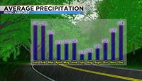
Wind is driven by temperature changes, which are more common in November than in January. Storms this time of year are usually driven by cold fronts. Some fronts can move quicker than others. A strong cold front that drops temperatures by thirty degrees and takes a long time to travel thirty miles, could easily mean a long lasting dangerous wind event in the valley. By January we typically don't see huge changes in temperature but in November we still can. Our chance for precipitation is higher in January compared to November, which lowers the fire threat as well.