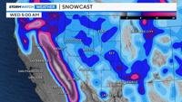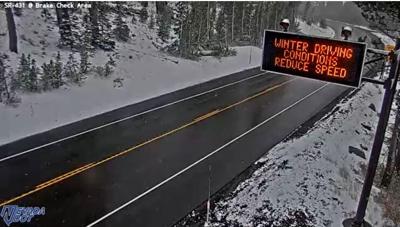

An early season storm is bringing impactful snow to the Sierra now through early Wednesday, with rain expected at lower elevations.
Snow levels are currently around 6,500–7,000 feet and will stay near that mark on Tuesday. Heaviest snow will fall south of US-50 this morning, spreading into the Tahoe Basin and southern Lassen County by midday, then continuing through early Wednesday. Areas above 7,000 feet could see over a foot of snow, while places closer to 6,000 feet may see lighter totals depending on snow levels.
For western Nevada, rain will move in by late morning, turning to snow above 6,000 feet Tuesday night. A Winter Weather Advisory is in effect for these higher elevations, where four inches or more of snow is likely, especially in the Virginia Range and higher terrain in Mineral, Douglas, Lyon, and Washoe counties.
Temperatures will stay well below normal - 15 to 20 degrees colder than average - through midweek, with overnight lows below freezing.
Conditions dry out later this week, but another system may bring valley rain and more mountain snow by late this weekend.
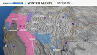
The Winter Weather Advisory has been extended to the Greater Reno-Carson City-Minden Area as well as Mineral and S Lyon counties. Rain today will transition to snow (above 6-6.5 kft) late this evening, bringing light accumulations to foothill communities. #nvwx #cawx pic.twitter.com/cs8yUuyEYd
— NWS Reno (@NWSReno) October 14, 2025