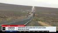
...FLOOD ADVISORY IN EFFECT UNTIL 645 PM PDT THIS EVENING...

* WHAT...Flooding caused by excessive rainfall is expected.

* WHERE...South Central Washoe County in western Nevada...

* WHEN...Until 645 PM PDT.

* IMPACTS...Minor flooding in low-lying and poor drainage areas.

* ADDITIONAL DETAILS...
- At 439 PM PDT, Doppler radar indicated heavy rain due to
thunderstorms. Minor flooding is ongoing or expected to begin
shortly in the advisory area. Up to 1 inch of rain has fallen.
- Some locations that will experience flooding include...
Virginia Peak and Nixon.
- http://www.weather.gov/safety/flood

PRECAUTIONARY/PREPAREDNESS ACTIONS...

Turn around, don't drown when encountering flooded roads. Most flood
deaths occur in vehicles.

&&
...STRONG THUNDERSTORMS WILL IMPACT THE SIERRA FRONT AND WESTERN
NEVADA BASIN AND RANGE THROUGH 515 PM PDT...

At 319 PM PDT, Doppler radar was tracking several strong storms
forming across the Sierra Front and the Western Nevada Basin and
Range. Storms will continue to form and move northeast this evening.

HAZARD...Wind gusts up to 40 mph and half inch hail.

SOURCE...Radar indicated.

IMPACT...Gusty winds could knock down tree limbs and blow around
unsecured objects. Minor hail damage to vegetation is
possible.

Locations impacted include...
Reno, Carson City, Virginia City, Pyramid Lake, Lahontan Reservoir,
Topaz Lake, Gardnerville, Sparks, Fernley, Dayton, Johnson Lane,
Hawthorne, Yerington, Wingfield Springs, Northwest Reno, Cold
Springs, Golden Valley, Virginia Peak, New Washoe City, and Hidden
Valley.

PRECAUTIONARY/PREPAREDNESS ACTIONS...

If outdoors, consider seeking shelter inside a building.

&&


MAX HAIL SIZE...0.50 IN;
MAX WIND GUST...40 MPH