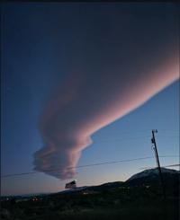
While it's a quiet forecast for Northern Nevada, it will be very wet the next seven days in the Pacific Northwest. This is a classic La Niña setup with the jet stream moving through Oregon, Washington, and Idaho.
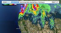
A strong atmospheric river will move through the Pacific Northwest early next week with heavy rainfall likely. Inches of rain will fall along the I-5 corridor including Portland and Seattle. The coast has a 70% chance of seeing four inches of rain between Monday and Thursday of next week. Flood Watches are up in Northern Washington as well.

Northern Nevada on the other hand will be dry and mild for this time of year. We will be south of the jet and protected from any storms moving in here. While there is a ridge in the Pacific there is a trough to our east.
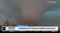
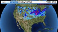
It is much colder in the Great Lakes and Midwest right now as a result. Chicago saw a good storm over Thanksgiving and the map above shows the path of snow staying east of Nevada, where the colder air is.

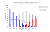
La Niña is forecasted to weaken over the next few months turning neutral towards the end of winter. There is nearly an equal chance of seeing a neutral or La Niña ENSO pattern during the months of January, February, and March. A weaker La Niña would lower the jet stream and allow colder air and storms to move into Northern Nevada.
Fingers crossed more snow will fall in the Sierra by the end of the year. A late start to the snow season does not always mean it will be a below average finish.