Critical fire danger and hazardous lake conditions are expected Thursday as forecasters warn of strong winds and low humidity across the region.
The National Weather Service in Reno has issued a Red Flag Warning and multiple Lake Wind Advisories for areas across western Nevada and eastern California on Thursday due to gusty winds and low humidity.

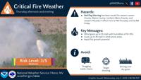
The Red Flag Warning is in effect from noon to midnight for fire weather zones covering eastern Lassen County, the Northern and Southern Sierra Front, West Humboldt Basin, Lahontan Basin, and northern Washoe County.
Winds are expected from the west to southwest at 15 to 25 mph, with gusts reaching 35 mph and up to 45 mph in wind-prone areas. Relative humidity is forecast between 10 and 15 percent.
"There is potential for 3 to 6 hours of gusty winds along with low relative humidity values," the warning states. "The combination of gusty winds and low humidity can cause fire to rapidly grow in size and intensity before first responders can contain them."
Residents are advised to avoid outdoor activities that could ignite fires, such as yard work, target shooting, or campfires.
Local fire restrictions should be followed. Updates and preparedness tips are available at weather.gov/reno and livingwithfire.info.

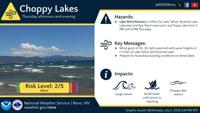
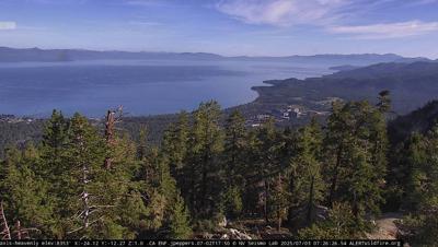
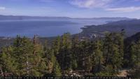
In addition to fire weather risks, a Lake Wind Advisory remains in effect from 2 p.m. to 8 p.m. for the Greater Lake Tahoe Area, including South Lake Tahoe, Truckee, Incline Village, and other surrounding cities.
Southwest winds around 20 mph with gusts up to 30 mph are expected to generate waves of 1 to 3 feet on Lake Tahoe.
"Small boats, kayaks and paddle boards will be prone to capsizing and should remain off lake waters until conditions improve," the advisory states.
A separate Lake Wind Advisory, also in effect from 2 p.m. to 8 p.m., covers Mono County in California, and parts of Nevada including Pyramid Lake, the Lahontan and Rye Patch reservoirs, and Topaz Lake.
West winds of 15 to 20 mph with gusts up to 35 mph are forecast, along with waves of 1 to 3 feet.
Boaters are urged to check conditions before launching and to postpone outings until wind speeds subside.
We'll also see a 20-30% chance of showers and thunderstorms, mainly across far northern Nevada, including areas near the Oregon border, as well as Pershing, Churchill, and Mineral Counties.
The window for storms opens around 1–2 p.m. and could extend into early Friday morning.
No severe weather is expected, but brief downpours and gusty outflow winds are possible with any storms.
For Independence Day, expect cooler-than-normal temperatures - highs in the 80s to near 90 in the valleys, with 60s and 70s in the Sierra. Conditions should stay mostly dry, though northern Washoe County could see a few isolated showers in the afternoon.
Winds will stay breezy, with gusts between 20–30 mph, but skies are looking clear for fireworks in most areas!
Looking ahead, a warming trend kicks off Saturday, with temps climbing back into the upper 90s by Monday and possibly hitting triple digits mid-next week in spots like Lovelock and Fallon. Things will stay mostly dry, though a few isolated showers can't be ruled out.