


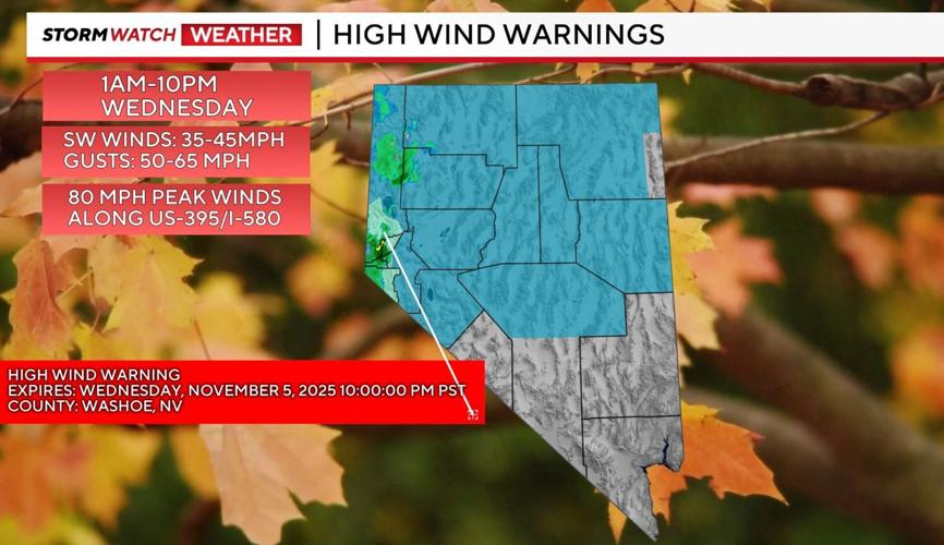
It’s been an active start to the day across Western Nevada, with winds gusting past 50 miles per hour and sustained speeds between 25 and 40 mph.
Gusts up to 65 mph are expected through the morning, with wind-prone regions along the Sierra Crest, Washoe Valley, and North Valleys possibly seeing gusts as high as 80 mph.
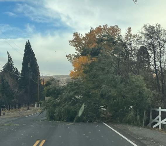
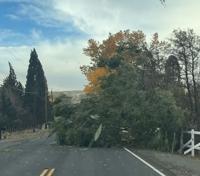
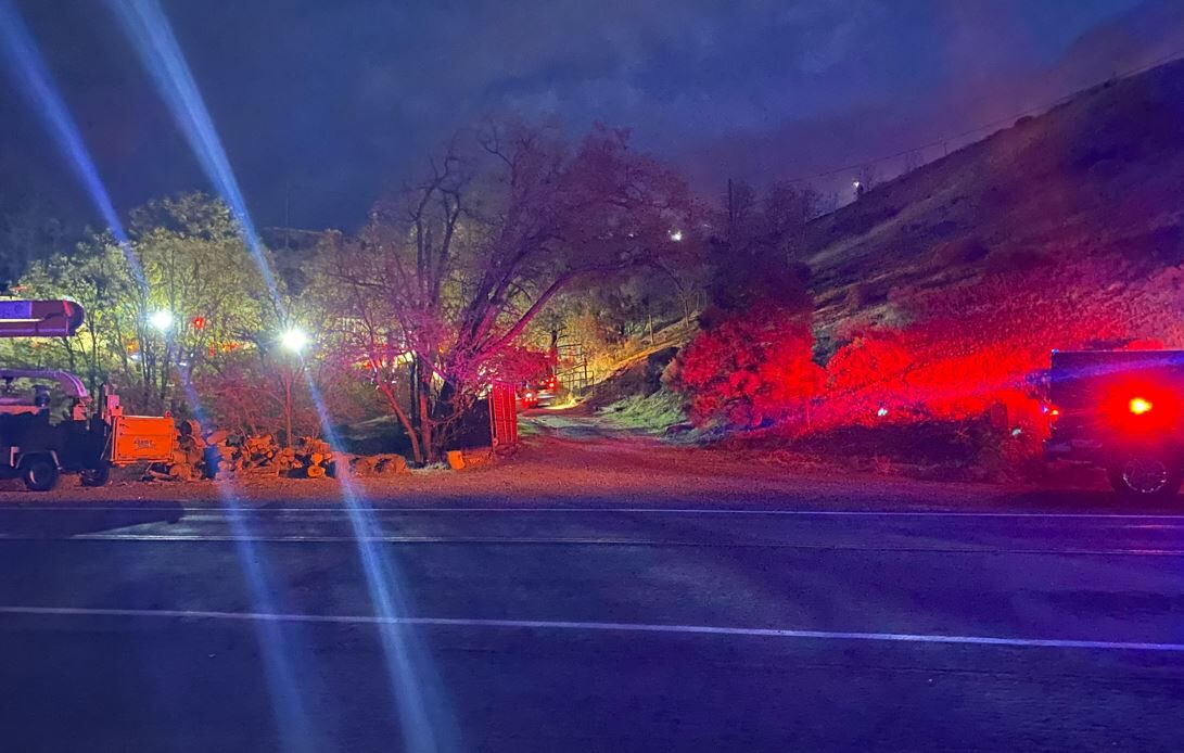
A downed tree on State Route 28 near Sand Harbor prompted Washoe County deputies to assist with traffic control. Nevada State Police, the North Lake Tahoe Fire Protection District, and NDOT crews helped clear debris from the roadway.
Maintenance teams continue to patrol and remove wind-blown debris along highways.
Travel Impacts
The storm is prompting chain controls on several mountain passes:
- I-80 eastbound at Kingvale and westbound at Donner Lake Interchange (traffic is currently backing up at Donner Lake)
- Ebbetts Pass (SR 4)
- Carson Pass (SR 88)
- Mt. Rose Highway (from mile marker 10 to Old Mt. Rose Hwy chains required on all vehicles except 4WDs with snow tires
CHP South Lake Tahoe Advisory:
In an online post, the South Lake Tahoe, California Highway Patrol reminded drivers to slow down and drive carefully in winter storm conditions. The reminder was prompted after a car on US 50 west of Echo Summit, traveling too fast for the road conditions, went into a ditch, CHP advised that no one was injured.
Further, noting that during storms, Caltrans can implement chain control restrictions at any time, and conditions in mountain passes can change rapidly. Drivers should always be prepared and check road conditions before traveling.
CHP Susanville Update:
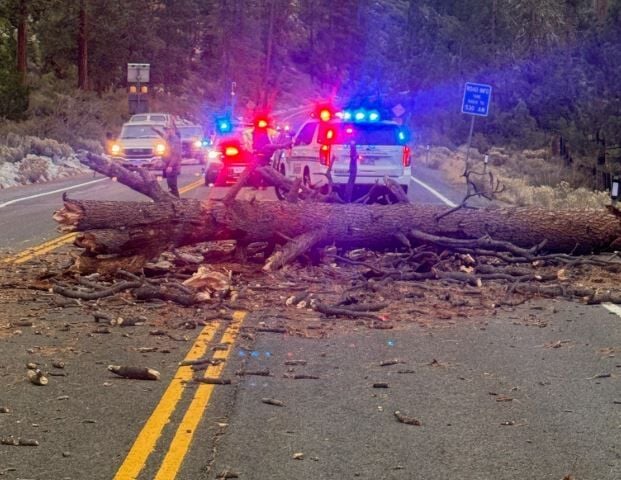
High winds continue across the area, causing multiple downed trees on highways. Drivers are reminded to exercise caution and check road conditions before traveling.
US 395 Status:
- A US 395 advisory was issued against driving high-profile vehicles from the Nevada border to the US 395/36 junction due to very high winds.
- Near Milford, a big rig overturned, but it is not blocking the road. Drivers should use caution and watch for emergency personnel in the area.
- Motorists are advised to avoid areas with downed power lines and trees and use alternate routes where possible.
In all areas, drivers should expect delays, reduce speed, and note that the speed limit within chain/4WD/AWD control areas on Interstate 80 is 30 mph.
A full list of current chain controls can be found on NDOT’s Nevada 511
- For California road conditions, closures, and chain requirements, check Caltrans QuickMap
At Reno-Tahoe International Airport, travelers are being warned to expect delays. Officials urge passengers to check directly with their airlines before heading to the airport. RNO reports a few diversions this morning, including flights rerouted to Fresno and Sacramento. Click here to see the arrival/departure list.
High winds are expected to continue today and may affect arrivals and departures. Please check your flight status directly with your airline. https://t.co/vinzXVivEC
— Reno-Tahoe Int’l Airport (@RenoAirport) November 5, 2025
Early Wednesday, a portion of Mt. Rose Highway was temporarily closed for avalanche control near Galena Creek.
Cleared: AVALANCHE CONTROL activities on SR-431 Both Directions from Mt Rose Summit Parking Lot to Galena Creek. All lanes blocked - use other routes. Start time: 11/5/2025 3:45 AM. End time: 11/5/2025 4:11 AM. Public Details: avalanche preparedness. 🗻
— Nevada State Police (@NVStatePolice) November 5, 2025
Heads up! An atmospheric river is bringing rain, strong southerly winds, isolated thunderstorms and high elevation snow showers to interior NorCal today. Give yourself extra time to reach your destination. #CAwx pic.twitter.com/fMljoZdpxp
— NWS Sacramento (@NWSSacramento) November 5, 2025
Weather Outlook
Showers are expected through the morning and afternoon, with most of the moisture favoring the Sierra and foothills west of Reno.
Conditions will calm down by this evening, leading into a quieter end to the work week and a warming trend that will bring above-average temperatures this weekend.
Power Outages and Safety Shutoffs
NV Energy is reporting dozens of power outages across Washoe County. The utility has implemented Public Safety Outage Management (PSOM) shutoffs for several northern Nevada communities—from Genoa and Minden to the Tahoe Basin and north to Carson City. Additional outages are possible throughout the day as high winds continue.
Find outage maps, PSOM zone details, and safety preparation tips at nvenergy.com/psom.
⚠️ Our crews are hard at work to make repairs to our system and restore power to customers after severe winds damaged our equipment throughout NW Nevada this morning.
— NV Energy (@NVEnergy) November 5, 2025
We appreciate the support and understanding while our teams work to restore power as quickly and safely as… pic.twitter.com/RLiOlKoGzb


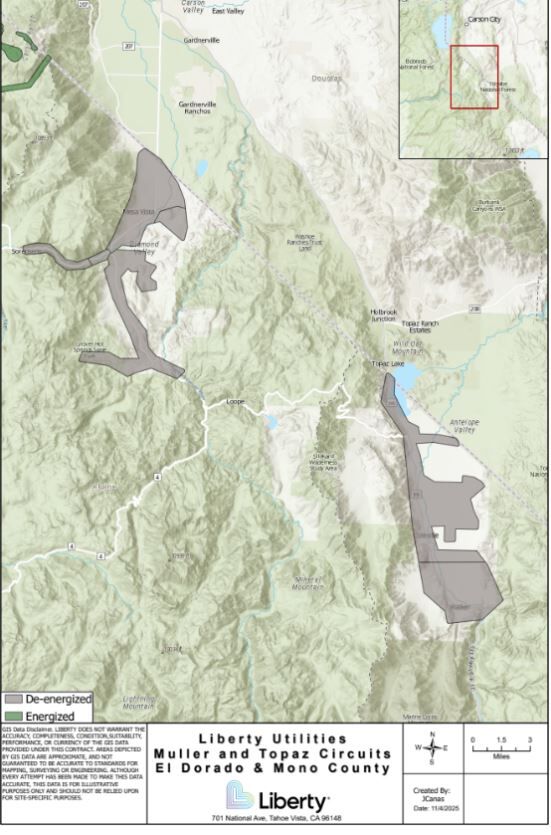

Meanwhile, Liberty Utilities has initiated a Public Safety Power Shutoff (PSPS) for Markleeville, Woodfords, Desolation Hotel (Hope Valley), Topaz, Coleville, and Walker, due to extreme fire weather conditions.
Fire Containment
A wind-whipped brush fire that sparked early Wednesday morning in west Reno near I-80 and West 4th Street has been fully contained. Reno firefighters say the blaze burned about half an acre. Crews are now mopping up hot spots to prevent embers from spreading in the gusty conditions.

Our maintenance crews are patrolling for/removing wind debris on highway roadsides.
— Nevada DOT Reno (@nevadadotreno) November 5, 2025
And you should be wind aware also!
🍃Leave extra travel time
🍃Drive slowly, with space between you and vehicle in front of you
🍃Watch for potential roadway debris pic.twitter.com/rwo3zCaRoe