This week if you ignore the middle is actually relatively mild, but there is in fact a period of seasonality sandwiched in between. We’ll stay…
From
To

Featured Top Story
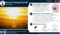
A stretch of June-like heat arrives this week, and it could rewrite a few records across the region.

Meteorology
Featured Top Story
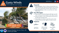
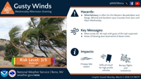
The National Weather Service has issued a wind advisory starting on Wednesday afternoon and running through Wednesday night for many areas throughout the region.

Featured Top Story
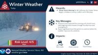
Gusty winds and mountain snow could make travel across the region difficult on Wednesday and Thursday.

Featured Top Story
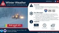
A major winter storm is lining up for the Sierra and Lake Tahoe, and it could reshape holiday travel plans.


Featured Top Story
Freezing fog and light snow could change the drive overnight with slick roads and lower visibility.

Featured Top Story
Rain in the valleys and snow in the mountains are keeping roads slick, and some highways are closed.


Featured Top Story
Sandbags are available across Northern Nevada and parts of California, ahead of winter storms that could bring possible flooding.

Featured Top Story
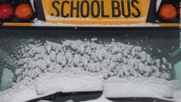
Inclement weather procedures are designed to keep students and staff members out of harm's way.


Featured Top Story
Strong winds are expected through the Sierra and Western Nevada on Wednesday, creating hazardous travel conditions.