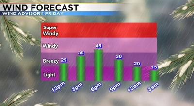
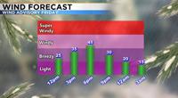
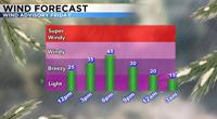
Another area of low pressure is expected to move through here Friday afternoon and evening but will not be all that impressive. Rain and snow amounts will be light even up in the Sierra but wind speeds could be strong. While fire danger will be higher, there will at least be some moisture to work with. Wind gusts could reach 50mph in the valley Friday afternoon and 65mph in wind prone areas. Sierra ridge tops could see wind gusts around 100mph.

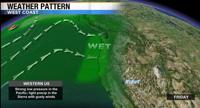
Wind forms when you have a difference in pressure which is related to temperature. When a strong front moves through it drops the temperature and pressure significantly which in return makes wind speeds stronger. Where we live the difference in elevation also creates a pressure gradient that can make wind speeds even stronger, especially in certain areas like Washoe Valley.

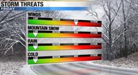
One positive to strong winds is that it breaks apart any inversions and makes our air much cleaner. When an inversion is in place it traps the cold air in the valley and can also trap pollution too. When winds are strong it breaks everything up and flushes out the cold air. This weekend will be mild with temperatures in the lower 50’s. A stronger system will move through Monday with another round of Sierra snow and valley rain headed our way.

?