...AIRPORT WEATHER WARNING...

The National Weather Service in Reno has issued an Airport Weather
Warning for...

Reno-Tahoe International Airport /RNO/.

The following weather hazards are expected:

Cloud to ground lightning within 10 nm of the airport.

LAT...LON 3960 11989 3960 11967 3942 11967 3942 11989
...THUNDERSTORMS DEVELOPING OVER WESTERN NEVADA...EASTERN SIERRA AND
NORTHEAST CALIFORNIA THROUGH 100 PM PDT...

At 1111 AM PDT, Doppler radar was tracking several showers and
thunderstorms develop over hte region, moving northeast at 10 mph.

HAZARD...Wind gusts up to 50 mph and pea size hail.

SOURCE...Radar indicated.

IMPACT...Gusty winds could knock down tree limbs and blow around
unsecured objects. Minor hail damage to vegetation is
possible.

Locations impacted include...
Reno, Carson City, South Lake Tahoe, Fallon, Mammoth Lakes,
Lovelock, Gardnerville, Virginia City, June Lake, Pyramid Lake, Lee
Vining, Lahontan Reservoir.

PRECAUTIONARY/PREPAREDNESS ACTIONS...

If outdoors, consider seeking shelter inside a building or vehicle.

Torrential rainfall is likely as the thunderstorm gain strength this
afternoon. Do not drive your vehicle through flooded roadways.
A Flash Flood Watch remains in effect until 9 PM this evening.

&&


MAX HAIL SIZE...0.25 IN;
MAX WIND GUST...40 MPH
...FLOOD WATCH REMAINS IN EFFECT THROUGH THIS EVENING...

* WHAT...Flash flooding caused by excessive rainfall continues to be
possible.

* WHERE...A portion of western Nevada, including the Greater
Reno-Carson City-Minden Area. This includes the Bug and Stallion
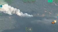
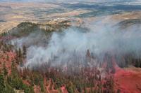
Fires.

* WHEN...Through this evening.

* IMPACTS...Excessive runoff may result in rock, mud, and debris
flows in and near active fire perimeters, steep terrain, and poorly
drained urban areas.

* ADDITIONAL DETAILS...
- Heavy rain from thunderstorms primarily during the afteroon and
evening hours today.
- http://www.weather.gov/safety/flood